


By Ellis Arnold, Colorado Community Media (AP Storyshare)
In 1967, Black Americans were mired in “the long, hot summer.” Frustrations over poverty, unemployment, discrimination and myriad other issues spilled into the streets, leading to clashes with police and arrests in many places, including Denver. The widespread tensions over race left President Lyndon B. Johnson searching for answers.
So, he issued an executive order for a report that would detail what caused the chaos. He wanted it to answer a crucial question: How can the country prevent more unrest in the future?
When the report arrived seven months later, it laid out hundreds of pages of analysis and recommendations for improving race relations in America.
But its message was best summed up in a sentence: “To continue present policies is to make permanent the division of our country into two societies: one, largely Negro and poor, located in the central cities: the other, predominantly White and affluent, located in the suburbs and in outlying areas.”
In other words, the issue of where people can live was at the heart of the report. It all ties into the American dream, the idea of a family owning a home, building wealth as that home increases in value over time and being able to live in whatever neighborhood a family can afford without fear of discrimination.
Yet more than half a century later, that divide between Black and White residents continues to complicate the dream in many parts of America, including the suburban towns and cities that surround Denver.
The divide is less stark and less known than it was in 1967, but its legacy is still alive in the metro area, where the Black population tends to live in Denver or Aurora, numbering in the tens of thousands in each city.
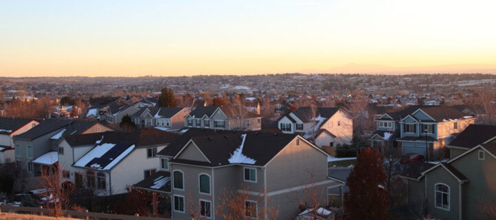
Homes sit in an upscale neighborhood in the south Denver metro area. Photo courtesy of Colorado Community Media
Elsewhere, Black residents number in the hundreds or just a few thousand while White residents make up strong majorities. White residents are 78% of the population in Arvada and 1% are Black. White residents are 80% of the population in Littleton and 2% are Black. White residents are 82% of the population in Castle Rock and less than 1% are Black.
So, why do the metro area’s communities look the way they do? The answer isn’t completely clear, but two map experts have delved into local property records, uncovering data that could help start to answer that question.
They’re trying to discover what many have either forgotten or swept under the rug about parts of the metro area — or simply never knew. They’re digging in at the neighborhood level, looking for words in property documents — called “racially restrictive covenants” — that excluded people from housing by race. They’re looking to discern the legacies that still echo in communities today.
Christopher Thiry, a map librarian at Colorado School of Mines in Golden, is one of the diggers. Discovering the covenants in Jefferson County shocked him.
“That blew me away that this rural county at the time would have them,” Thiry said. “As I tell people, ‘Yeah, the suburbs of Birmingham, Alabama, sure. But Jefferson County? Come on.’”
‘Only persons of the Caucasian race’
Thiry, a longtime resident of Golden, took inspiration from the “Mapping Prejudice” project, an effort at the University of Minnesota to identify and map racial covenants.
He jumped into his work after the killing of George Floyd by a Minneapolis police officer. The mapping is a tedious task of sifting through mostly mundane, uncontroversial rules, like how many feet a house must sit away from the road or bans on billboards in front of homes.
Thiry has examined about 1,000 Jefferson County documents and found nearly 200 had some kind of race-based stipulation. He looked at documents from the 1860s to 1950, though most of them were from the 1910s to 1950.
Specifically, he has pored over “plats,” or plans for new neighborhoods. The plat for one neighborhood — Cole Village, located along Colfax Avenue near Kipling Street in what’s now Lakewood — had this to say:
“Only persons of the Caucasian race shall use or occupy any building or any lot. This covenant shall not prevent use or occupancy by domestic servants of a different race.”
The document was registered with the county in 1945. That type of race-based language is now unenforceable but remains on official plats, property deeds and other documents, according to Thiry.
It wasn’t just developers who pushed such language, Thiry said.
Local elected and appointed officials of the government of Jefferson County signed the documents, Thiry added.
He singled out some other examples:
- “Ownership in this subdivision shall be restricted to members of the Caucasian race,” says a planning document for Sunshine Park in Golden at Sunshine and High parkways, dated 1944.
- “Stipulate that no lot at any time shall be occupied or owned by any person or persons not of the Caucasian races. However, this provision shall not prohibit the employment of persons of other races by the occupants,” says the plan for Green Acres along 6th Avenue in what’s now Lakewood, dated 1939.
- “No (area) shall at any time be occupied or owned by any person or persons of other than the Caucasian race, however, this shall not prohibit the employment of persons of other races on the premises by the occupants,” says the plan for Happy Valley Acres in the Golden area at South Golden Road and Orion Street, dated 1939.
- “The said (land) shall (be) used for no other purpose than for the building and maintaining thereon and the occupancy thereof of private residences by Caucasians, and the erection of necessary outbuildings,” says a planning document for part of the Indian Hills area, dated 1923.
Thiry has used his findings to make a map of the parts of Jefferson County where race-based rules were baked into the original plans of the housing developments.
Many are concentrated in what are now the Wheat Ridge and Lakewood areas, with a handful dotting the Golden and Arvada region. Others sit in the Evergreen and Indian Hills areas.
It’s not yet a complete picture. Thiry is wary that he may have missed pieces. Though the map is a work in progress, it already has him wondering how the covenants still influence lives today.
Beyond that, what can be done to right past wrongs.
His work has made one measurable impact. It has inspired the work of another mapper, Craig Haggit, a map librarian at Denver Public Library.
Haggit, who is looking into where racist restrictions lurked in the paperwork for housing in Denver, also wants to shed light on “the way forward” for communities.
“I feel like we can’t know where we’re going until we know where we’ve been and how we got there,” Haggit said. “Otherwise, you’re just (in) the dark.”
It could take years to look through all the documents. But so far, Haggit’s work has revealed racial restrictions in Denver that targeted people in “a mix” of ways.
“Sometimes, it’s excluding ‘Negro’ or ‘Asian’ or ‘Mongoloid’ or whatever terms they used. And sometimes it just says only White people” can live in a certain house, Haggit said.
His team at first zeroed in on the 1930s because the Ku Klux Klan was so active in the 1920s in the metro area. Since he’s in the early stages of the research, Haggit is unsure which neighborhoods were home to large concentrations of racially restricted housing.
One clue could be redlining, a term that refers to marking areas red on color-coded federal maps in the 1930s, reflecting the practice of restricting access to home loans in certain areas, partly based on race. That disparity stood in the way of homeownership for majority-Black areas and other groups in urban cities.
Though he doesn’t know yet, Haggit expects that the neighborhoods that were not redlined — the ones deemed higher class — would have the- restrictive deeds because they were trying to keep certain people out.
In Denver, redlining zeroed in on predominantly Black neighborhoods, but it also covered neighborhoods where other ethnic or religious groups were present, according to the Denver redline map as displayed by the “Mapping Inequality” project from the University of Richmond and other university teams.
Denver’s redlined areas at the time included some western parts of the city and areas that surrounded downtown. But the map also redlined a small part of Aurora along Colfax Avenue — and parts of west and central Englewood. (A sliver of Jefferson County in the Edgewater area landed on the map too, though it was rated slightly higher in yellow.)
The map reflected the view that people of certain backgrounds negatively affected the values of homes.
In Englewood, for example, an “encroachment of Negroes” in an area near what appear to be railroad tracks was listed under “detrimental influences” in comments that accompany the map.
And for the Five Points area near downtown Denver, comments mention “Negroes, Mexicans and a transient class of workers.”
Just to the east, comments called the neighborhoods “a better Negro section of Denver” and “one of the best colored districts in the United States.”
“Were it not for the heavy colored population much of it could be rated” higher, the comments say, appearing to use the term “colored” to refer to residents who were not White.
Effects linger ‘to this day’
Though the picture isn’t entirely clear yet, what experts already know suggests that policies that deepened racial disparities influenced the makeup of today’s suburbs.
One driver of suburban growth that was especially visible was the American GI Bill — or the Servicemen’s Readjustment Act of 1944 — that provided World War II veterans funding for college tuition and low-interest mortgages. But not everyone reaped the same rewards because of the covenants that the mappers at the local libraries are looking into, along with unequal access to GI Bill benefits for White veterans compared with Black veterans.
The disparities played into how largely White the demographics in the suburbs turned out to be, said Christy Rogers, a teaching assistant professor in the program for environmental design at the University of Colorado Boulder.
“That has consequences for intergenerational wealth,” Rogers said.
In other words, though the descendants of White military veterans saw their homes rise in value over the decades, essentially becoming investments, many Black families encountered barriers and that had a ripple effect as they could not pass down as much wealth to their children and grandchildren.
Rogers, who is White, knows this firsthand.
“My dad got the GI Bill, and he went to college and bought a house,” Rogers said. “So, our family could draw on our home value to send me to college.”
It took decades for federal lawmakers to ban the practice of racially restrictive covenants. They were banned in the months after the “long, hot summer” of 1967 — through the Fair Housing Act of 1968, which bars discrimination in the sale, rental and financing of housing based on race, color, national origin, religion or sex. The act also prohibited redlining.
What’s left today is a puzzle in places like Jefferson County, made even harder to discern after booming growth since the mid-1900s. It is difficult to tell how much past covenants shaped the suburbs, said Thiry, the Colorado School of Mines librarian.
“With that said, you cannot discard the fact that these covenants did exist,” Thiry said.
The prevailing attitudes of racism at the time still may have made Black families feel unwelcome in certain neighborhoods, Thiry said.
There is evidence that the researchers are onto something. In Minnesota, researchers looking into Minneapolis and its suburbs discovered a “bonus value” persists today among White homeowners who benefited from restrictive covenants.
“We document that houses that were covenanted have on average 3.4% higher present-day house values compared to houses that were not covenanted,” according to a 2021 University of Minnesota study entitled, “Long Shadow of Racial Discrimination: Evidence from Housing Racial Covenants.” “We also find that census blocks with a larger share of covenanted lots have smaller Black population and lower Black homeownership rates.”
The study also noted, “the racial makeup of neighborhoods determined in preceding decades persisted, where the region was highly segregated with White families primarily residing in suburban areas and Black families within select neighborhoods (in) parts of Minneapolis.”
“This segregation has continued for more than fifty years, suggesting the highly long-lasting effect that covenants had on the racial distribution of the region,” according to the study.
Rogers at CU added that moving to the suburbs could be more difficult for residents in redlined areas who may not have the money to move.
“Redlined areas to this day (sometimes) have lower appraisal values compared to a house across the street that’s not in a redlined area,” Rogers said.
The path forward
Many Denver-area suburbs have large White majorities today. About 20 cities, towns or rural counties have a larger proportion of White residents than the national rate and the Colorado rate — many by a large margin, according to U.S. Census Bureau data.
In Cherry Hills Village, a wealthy suburb that borders Denver, the number of Black Americans amounts to 0% of the population. Just a few miles away, the population is 17% Black and 44% White in Aurora, one of Denver’s most diverse suburbs.
Aurora is an exception, not the rule. Many of Denver’s other older suburbs are much less diverse.
Several Adams County cities have large Latino populations, but even though they’re suburban, the cities still tend to have lower-income neighborhoods closer to Denver and more expensive housing farther north.
Still, the suburbs don’t entirely look like they used to, according to Yonah Freemark, senior research associate at the nonprofit Urban Institute, based in Washington, D.C.
“Overall, the suburban parts of the nation have transformed dramatically and have become more diverse over time,” Freemark said.
That’s in terms of age, ethnicity and race, and income, Freemark added.
In the future, some suburbs will likely undergo a “steady transformation” toward increased mobility, such as having more public transportation, Freemark said. Other changes could include more efforts to get people walking and biking, with the transition of suburban storefronts and strip malls into more walkable neighborhoods, he added.
The path forward for the suburbs may involve a continued increase in diversity of residents, Freemark said.
But that depends on whether states and the federal government will expand support and requirements related to affordable housing, Freemark said.
“We’re going to need significant public investment and changes to public law to support those outcomes,” Freemark said. “Otherwise, little is going to change.”
The affordability issue transcends race, with many people simply priced out of the housing market and those who are in it struggling to afford what they need for their families. In 2010, the median single-family home price in metro Denver was about $200,000. It was roughly triple that as of 2022.
Coupled with affordability is an availability issue that local rules play a role in exacerbating. Large-lot zoning — planning for houses to be built on large portions of land — is one major issue. In other words, there are too many large homes being built and too few starter homes, leaving prospective first-time homebuyers with few options, perhaps even relegated forever to renting.
“If you have a very expensive large-lot neighborhood, you don’t get young families,” Rogers said. “You don’t want your community to box out young families or new Americans. Or, you end up with, in a sense, a retirement community, and there’s nothing wrong with a retirement community, but you don’t want your entire community (to be that). You want kids to be in your schools.”
The long-term trend of rising housing prices plays a role, too, as wages fail to keep pace with housing costs.
That “has the potential to continue to widen inequality and even perhaps embed it,” Rogers said.