


PHOTOS PROVIDED BY THE CARNEGIE LIBRARY FOR LOCAL HISTORY, DENVER PUBLIC LIBRARY SPECIAL COLLECTIONS, GREELEY HISTORY MISEUM, LONGMONT MUSEUM, AND USGS HISTORICAL MINING PHOTOGRAPHS
Fruit Orchards, Broomcorn, and 1950s American Boomtowns
In 1945, as American war veterans returned home from the Second World War, Denver was a small and compact agricultural hub. Many of these war veterans had fond memories of training in Colorado before shipping off to fight in Europe or the Pacific. When the Allies won the war, more than a few of the young veterans chose the Queen City to establish the dream of a solid, middle-class American life. The coming boom would soon create a housing shortage.
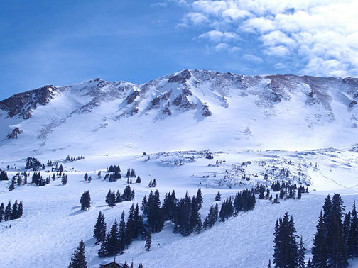
At that time the north edge of Denver was around 48th Street. Lakeside Amusement Park, near 44th Street and Sheridan Boulevard was on the outskirts of town with neighborhoods to its south and fields to its north. Far away to the northwest was the burgeoning university town of Boulder, where 28th Street was still a gravel road. The Denver-Boulder Turnpike would not open as a toll road for another seven years. Motorists who made the trek to Boulder from Denver — often as tourist daytrippers — would take Highway 287 north up Federal and Old Wadsworth Boulevards and then make a sharp westerly cut over to Boulder on Highway 7 at the World War I Pillars in Lafayette.
By 1945 Lafayette and its immediate neighbors like Louisville and Erie had already existed for many decades as coal mining towns. Between these coal towns in the north and the northern edge of Denver near 48th Street, some 25 miles to the south was mostly a no man’s land of prairie with some large fruit orchards and dryland farms scattered about. There was little natural water in this open expanse and not much to attract development except for wide open space with the Rocky Mountains as backdrop to the west.
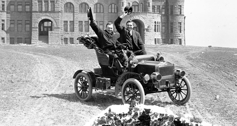
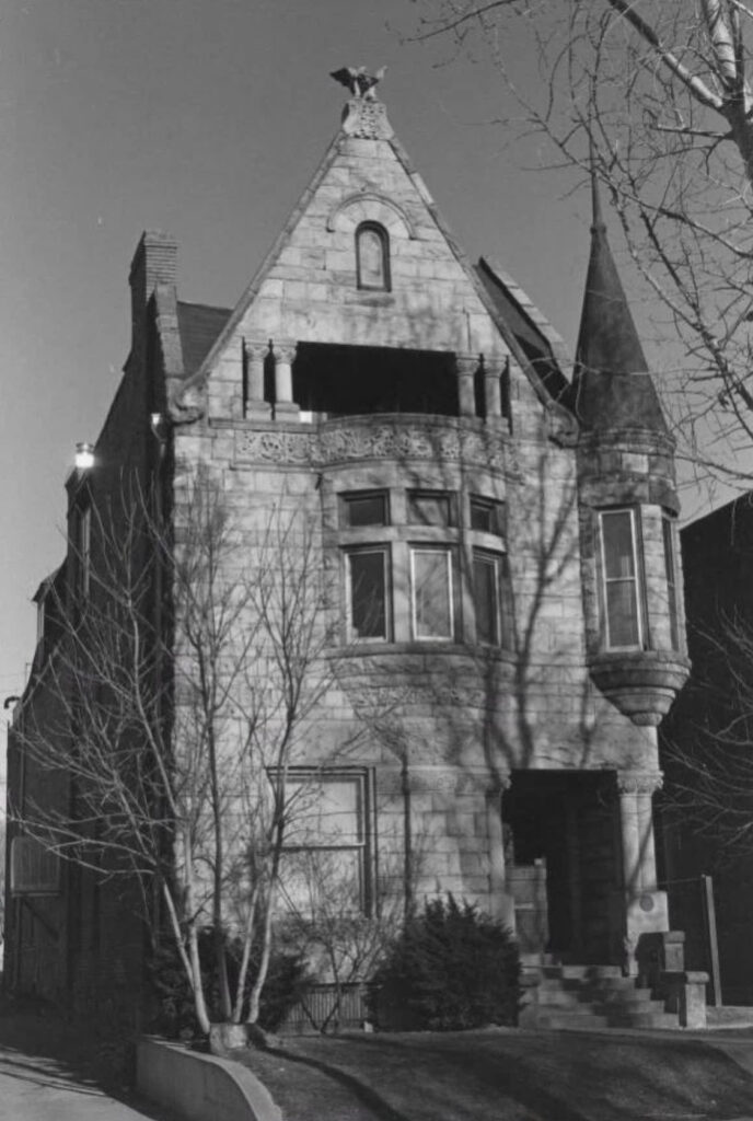
1895. Westminster College, now Pillar of Fire Church Harry Rhoads behind steering wheel
But open space is exactly what was needed as the explosive growth of the 1950s approached. A booming metropolitan area required new housing for a rising middle class of people with disposable incomes interested in a two-car garage and a yard for the kids and the dog. Corporate real estate development companies stepped in to fill this demand, not just with houses, but with whole planned communities complete with schools, churches, and shopping.
That is how Northglenn, my home town, and Thornton came into existence. In 1962 Life Magazine named Northglenn America’s “most perfectly planned community” courtesy of the gray-suited businessmen of Perl-Mack Company. The company built its 3,000-home, full-service community called “North Glenn” in 1959, right out of a 280-acre prairie field near what would later become the intersection of Interstate 25 and 104th Avenue.
A few years before “North Glenn” was built, a little to the south was the planned community of Thornton on 400 acres near 88th and Washington Streets. Thornton, named after Colorado’s then governor Daniel Thornton and built by developer Sam Hoffman, emerged from the fields in 1954 and was incorporated as a city in 1956.
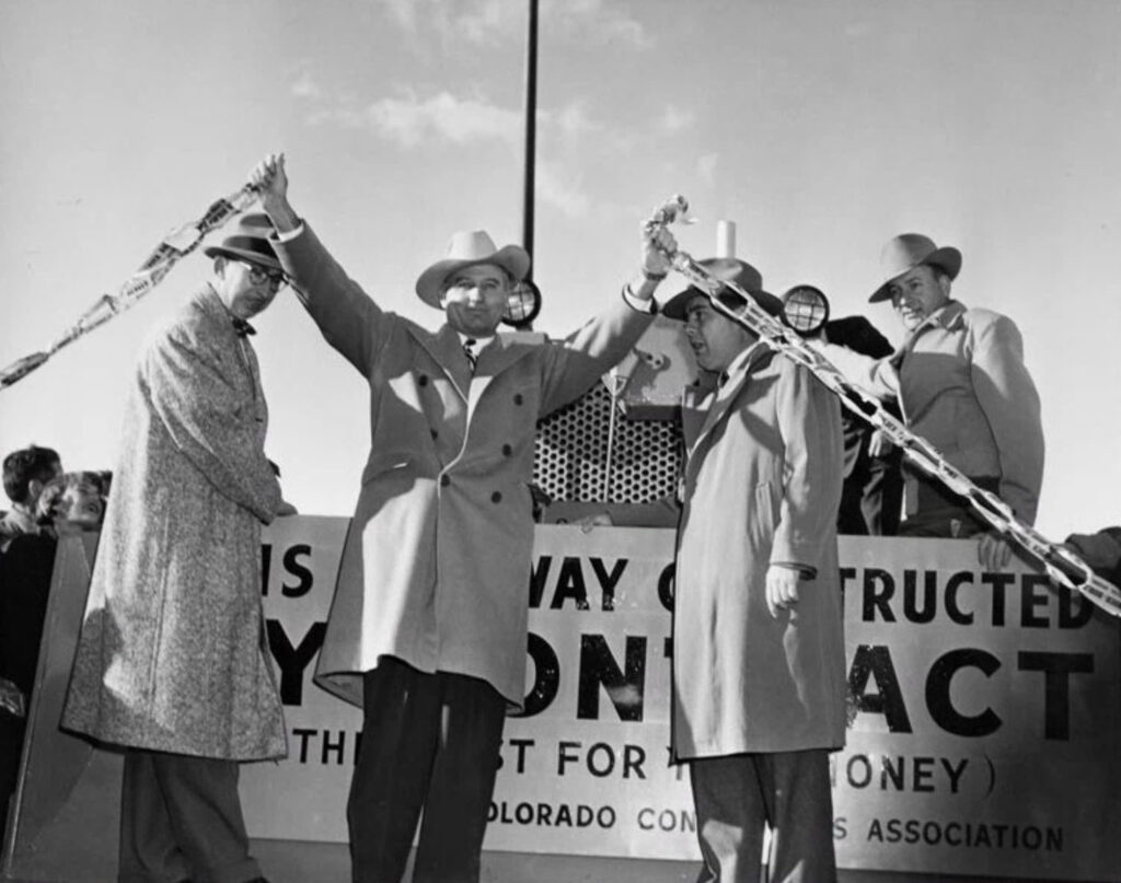
19 Jan. 1952. Governor Thornton at Denver-Boulder turnpike ribbon cutting.
Westminster and Broomfield date back to the late 1800s as unincorporated communities with homestead settler roots from the Gold Rush era. But these rural villages also grew into modern Denver suburbs through similar corporate-planned communities in the 1950s. In Westminster and Broomfield the construction of the Denver-Boulder Turnpike and the opening of the nuclear weapons facility Rocky Flats, both in 1952, were major employment and development draws. Such began the long march of suburban sprawl that, by the turn of the century, would ultimately merge the north Denver suburbs with the growing town of Boulder to the northwest.
Before there was a Westminster, there were fields of apple and cherry trees planted by the earliest pioneer settlers to the area. The ocean of spring blossoms in those days must have been a glorious sight against a backdrop of snowy peaks to the west.
To see some evidence of this past, take a little trip next September to the Two Ponds National Wildlife Refuge near 80th and Kipling Streets. It’s a wonderful little oasis of nature in the midst of suburbia. As you walk the gentle gravel trails along the banks of the reed-filled ponds with croaking frogs, you will notice many large apple trees in the adjacent fields. That time of year it’s likely that their branches will sag with thousands of ripe apples, the ground below covered in fallen fruit.
The apple and plum trees at Two Ponds are very old. They are relics of this area’s history as a major fruit-growing center. Today’s Shaw Heights neighborhood in Westminster, for example, used to be a large apple and cherry orchard that operated continuously between the 1890s and 1938. This and other area orchards were large enough to justify a railroad spur in 1881 to haul off the many tons of apples and cherries to grocers all across America.
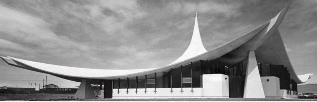
1963. St. Stephens Lutheran Church being built in Northglenn, Colo
The center of this fruit farming life began in 1870 when homesteader Pleasant DeSpain built a home on 160 acres near present day Lowell Boulevard and 76th Street. DeSpain may have been the first to grow fruit trees in the area, and the operation he and his five sons built attracted a small growing community that became known as DeSpain Junction. DeSpain’s great-great grandson who shares the same name was born in Denver in 1943 and is a renowned author, children’s picture-book storyteller, and world traveler. He earned high accolades for his signature children’s book, “Old Joe and the Carpenter”; wrote an adventure travel memoir titled, “Vagabond Tales, In Search of Light and Life”; and produced a weekly children’s storytelling television show called, “Pleasant Journeys” that ran in Seattle for five years in the 1970s. This earned him the honorary title of “Seattle’s Resident Storyteller.” He is quite an interesting individual.
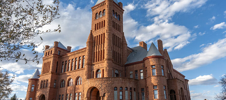
In 1911 a developer named C.J. Harris bought much of the land in and around DeSpain Junction and subdivided it into smaller fruit orchard lots. The new town was incorporated and named Harris. As locals in the growing community thought about the future of their town, some of them dreamed up a plan to create a university so fine that it would be considered the “Princeton of the West.”
Westminster University was a short-lived venture after each and every one of its male Presbyterian students shipped off to serve in the Great War in 1917. The young university never reopened, but the grand castle-like structure made from Colorado red sandstone remains, now privately owned by the Pillar of Fire Methodist Church.
Although I personally think “Pleasant DeSpain” would have made for a more unique name, “Westminster” is what stuck. Westminster’s population in 1950 at the dawn of its development boom was just 1,686. By 1960, with the Turnpike and Rocky Flats completed, it was home to 14,000 residents. Today more than 111,000 people live in Westminster making it one of Colorado’s ten largest incorporated cities.
It should be recognized that the city of Westminster today sits atop a location where there is strong evidence of a semi-permanent Arapaho Tribe encampment. This is thought to have been near Gregory Hill at present day 80th Street and Federal Boulevard. Human habitation in this area goes back at least 14,000 years. It is thought that the corridor where the High Plains meets the Rocky Mountains was used as an annual migration circuit by archaic peoples who would spend summers hunting in the high country and winters sheltering on the adjacent plains.
More recent Indigenous peoples acquired horses from the Spaniards who ventured into the area from the south. These later tribes roamed far and wide on horseback over the Great Plains following herds of bison on which they depended for food, shelter, and tools.
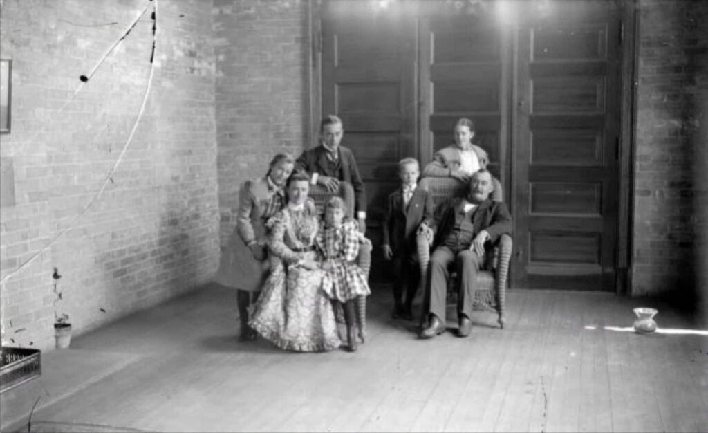
1886-1901. Adolph Zhang Family
By the time Pleasant DeSpain had settled in present-day Westminster in 1870, the Indigenous peoples of the area had largely and tragically been marginalized and removed. Their populations were greatly diminished, their livelihoods were stripped away, and their homelands were stolen. Survivors of this apocalypse were forced onto reservations far away.
The fruit orchard business extended for miles to the north of present-day Westminster. In 1885 Adolph Zang acquired 4,000 acres at present-day 120th Street and Wadsworth Boulevard to grow fruit trees and breed horses. By the time Mr. Zang arrived in the area, the U.S. Postal Service had already set up a remote post office nearby what they called Broomfield after the broomcorn that grew well in the area. Not a food crop, broomcorn is a stiff-stemmed sorghum that was used for the bristles on brooms. It is still used today as craft material for wreaths and other such decorative items.
1995. Adolph Zhang’s (Orchard Farmer’s) House
From its very beginning Broomfield was a crossroads town for both rail and wheel. The Old Cherokee Trail, the main stagecoach route, passed through it, later to be replaced by Highway 287 up Old Wadsworth. Tracks for the Denver-to-Cheyenne Colorado Central Railroad passed through the location in 1873 before it was even settled, and several other rail lines were added in the late 1800s.
The Denver area’s original “light rail” electric commuter train opened in 1908. Known as the Kite Route, this electric rail line ran between Denver and Boulder, through Broomfield, and then towards the coal towns to the east. At its height the electric Kite Route offered 27 stops. The company that operated the train built a depot with associated community services at the corner of 120th and Wadsworth. This depot still stands today as the preserved Broomfield Depot Museum.
1983 Oct. 15. Nearly 15,000 people encircled the Rocky Flats Nuclear Weapons Plant to protest the nuclear arms race.
By this time the little community of Broomfield had taken root and was even home to the Broomfield Cheese Factory. But the population was stagnant at around 100 residents until the 1950s. Like the other north metro communities, the 1950s brought explosive growth. The Turnpike Land Company bought the Zang property in 1955 to develop a planned community they called the City by the Turnpike. It was a massive undertaking designed for 20,000 residents that ultimately became known as Broomfield Heights.
With the opening of the Denver-Boulder Turnpike and Rocky Flats and the resulting housing boom, Broomfield was on its way from its farming and transportation crossroads roots to becoming the modern suburban city and tech industry hub of 75,000 residents that we know today. The growing city had the unfortunate distinction of being part of four different counties, each with its own laws and regulations. Broomfield solved this challenge at the turn of the century by forming its own county to become the city and county of Broomfield, a unique distinction it shares with the city and county of Denver and just a handful of other city-counties in America.
Growing Together
By 1968 the young cities of Northglenn, Thornton, Westminster, and Broomfield were all well established. But they were still isolated communities surrounded by open space on all sides, even to the south towards Denver. 1968 was the year my parents, Linda and Phil Geiling, moved to Colorado from Florida. Mom was a teacher and Dad a child school psychologist. The retired snowbirds moving down to Florida at the time had little interest in paying more taxes to fund their education system, so my parents went looking for greener pastures and ended up in Colorado. They bought a piece of land in Broomfield, way outside of the city at the time, to build a home. They gave up on that idea within a year, sold the parcel of land, and bought a California-style house on a half acre off of 99th and Huron Streets in Northglenn for $29,000.
I was born in 1974, and this was the house I grew up in until I left for college in 1993. I would learn through researching this article that it must have been among the first houses built in Northglenn, although not part of the original planned community off of 104th.
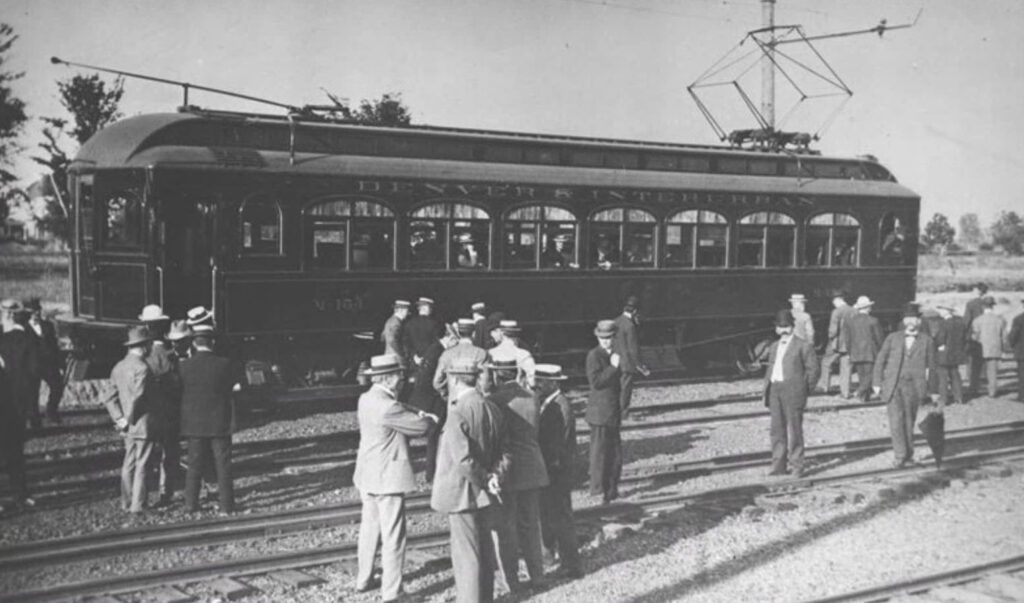
1908. Men boarding train
My earliest real memories are from around 1980. By then the neighborhood had filled in. When my parents first bought the house in 1969, the neighborhood was only half built, and the view to the west was mostly open space. I asked my mom where she perceived the “edge of the city” was back then. She zeroed in on 84th Avenue, but the edge of the city wasn’t that clear as there was still a lot of undeveloped land even south from there.
“I remember driving along 84th,” she said. “Looking south there were still many open fields between 84th and Denver. There wasn’t much at all to the north of 104th. Huron was a dirt road north from there.” She recalled that the Red Lobster may have been the first business to appear on 104th Avenue to the west of Huron, and then the car dealerships followed in a few years. By around 1980, “The area was pretty much built out,” she said.
Before speaking with my mom for this article, I never realized how quickly my hometown grew in just the decade before I was born. There was literally nothing there but fields in 1959 and by 1979 Northglenn and Thornton were fully developed suburbs.
For me, it was a great place to grow up. On clear days when the notorious Denver brown cloud was cleared by fresh winds, we could see the downtown Denver skyline to the south from the house. The “big city” seemed a world away then, even though it was only nine miles. On my street my older brother and I had many friends our age, and the adults all knew each other well, even becoming long-time friends.
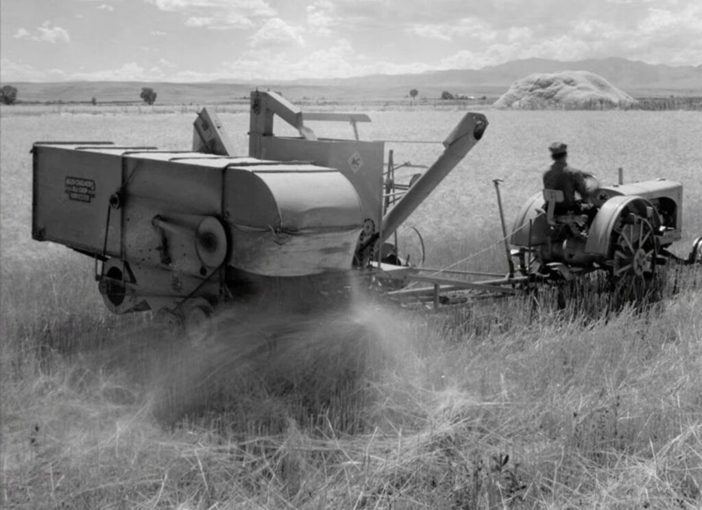
1929-1939. Farming equipment in use.
In speaking with my mom, I recalled the fun all the kids would have sledding down our steep street on snow days or weekends on the old-time runner sleds we had. To my amusement my mom told me that the neighborhood adults would often take their turn on the sleds at night after we kids went to bed. And apparently, unbeknownst to me, when my dad followed behind at a distance while we went trick-or-treating, as a joke, he would knock on the same doors we just left with a mug in his hand for “trick-or-drinking,” ending up with a toxic stew of various beers and liquors in that mug for his loot.
This was 1980s suburban life America, when crime was high but most people didn’t worry too much about it because the news of it wasn’t blasted 24 hours a day. We rode our bikes in the summer up to Webster Lake or Croke Drive Reservoir to catch bluegills or south to the field that was near Thornton Parkway where there were a series of sweet dirt jumps we called the “tip-ups.” Helmets were never worn, and curfew was “dark.” On many summer nights after dark the neighborhood kids would often gather at one house or another for wild games of kick-the-can. I would go to bed mosquito-bitten and exhausted but ready to do it all over again with all my friends the next day.
The innocence of the 1980s passed, and with a new decade I became a Northglenn High School Norseman in 1990. My circle of friends came from a mostly lower middle-class background. We were about half white kids and half Hispanic. My Hispanic friends were all multi-generation Americans who spoke no Spanish whatsoever, which was often the source of good-natured jokes. Mostly we didn’t pay any attention to superficial differences. We were just friends — and still are to this day.
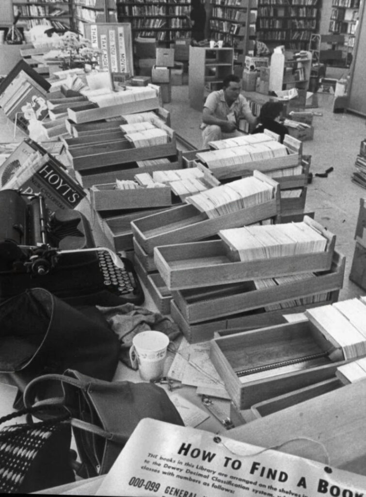
1963. Librarians work in Thornton.
Still, things always change, and the 1990s brought significant cultural shifts. Urban gang culture encroached into the North Metro communities, especially Northglenn and Thornton. High crime rates and drug abuse entered our awareness at a time when new driver’s licenses and beater cars gave us the ultimate freedom to learn our boundaries, sometimes the hard way.
One of my friends had an old Chevy Chevette hatchback that he bought somewhere for $200. He could make it backfire on command, and it finally died one day when the gear shifter broke off in his hand. On snowy nights we would take turns towing each other on snow tubes down Thornton’s residential streets. On other nights we would take joyrides north where most of the roads north of 120th, like Huron, turned to dirt. From there we would sometimes turn off the roads straight into the fields to flush out rabbits just for fun. Many weekend nights were spent cruising “Westy Mall,” not having any clue what we were looking for or how to find it, but somehow wanting to be there with our friends doing nothing in particular but hanging out trying to look cool nonetheless.
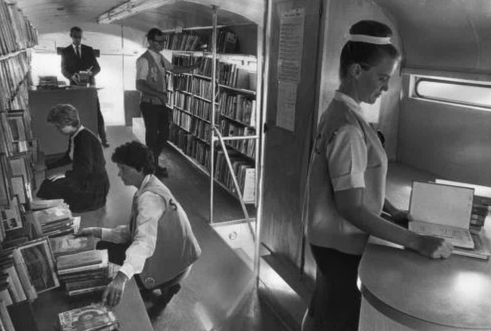
1964. HELP (Helpful Extra Library People) volunteers work in the Adams County Library bookmobile, in Northglenn, Colorado
In those days Thornton’s new Horizon High School, built in 1988 way up north off of 136th Avenue, was where the snobs went — “rich” suburban kids with nice new cars living in nice new houses on the edge of the city. Holly Street, near Horizon High, now a busy, four-lane suburban thoroughfare, was a dirt road on which we would gun our engines up to 60 mph, kicking up plumes of dust just because we could.
Things change. My 12-year-old daughter will probably attend Horizon High as she will be a freshman in two short years. By then the school will be 37 years old, 12 years older than Northglenn High was when I entered high school. And, I still think of Horizon as the “new” school!
Reflecting on my research and recollections for this article, I am struck by how recent all of this history is and by how dramatic the changes and growth have been in just a few short decades. As the edge of suburbia continues to push north, now past Lafayette and Erie and into the Tri-Towns of Frederick, Firestone, and Dacono, I wonder what the destiny is of the North Metro suburbs where I grew up.
My mom and dad sold the house in Northglenn in 1998 to follow a retirement dream and move to the mountains, finding a new home outside of Salida. After my dad passed away in 2014, my mom decided to find a second home in the Denver area. She found a quiet little house in Old Town Erie in 2015. I asked her if she felt there were similarities between Erie in 2015 and Northglenn in 1968. Was it a bit of a return to those first days in Colorado when they moved to the edge of the city to a place undergoing rapid growth? “I did notice similarities,” she said. “Moving to Erie in 2015 was a lot like moving to Northglenn in 1968.”
And time marches on.