


Historical photos provided by the Carnegie Library for Local History & Boulder Historic Society
Landscape shaped by water
There is a certain clarity of sound early in the morning. Each step I take brings a satisfying crunch as my foot strikes the dirt trail. It’s dawn, and I’m hiking up the hill at Rabbit Mountain Open Space on the edge of Lyons, Colorado.
The National Weather Service has issued a flash flood watch today. Tropical Storm Harold has tossed his remnants all the way up into the Colorado Rockies from the Gulf of Mexico. The expected rain has yet to arrive, but the cloud deck is building.
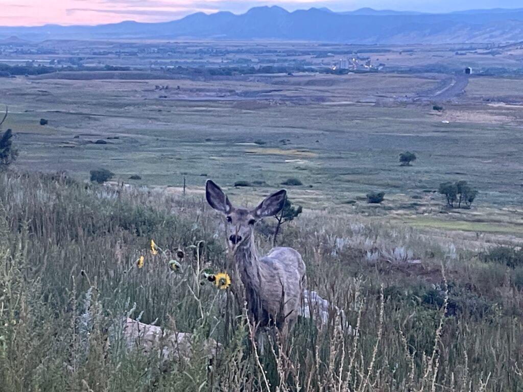
A curious deer watches me pass on the trail in the Rabbit Mountain Open Space near Lyons. Photo by Doug Geiling
Summer mornings in the Front Range are usually clear and sharp. The approaching weather gives the landscape a softer look. It is beautiful, nevertheless. But the coming rain brings worry. Almost ten years ago to the day a massive flood hammered Colorado’s Front Range and foothills communities, including beautiful Lyons. No one here likes seeing a flash flood watch in their weather forecast.
As I climb higher the trail leads me through an open prairie slope into a forest of stunted ponderosa pines amongst mountain mahogany and gamma grass. A deer watches me pass, and a cottontail rabbit scurries under a bush.
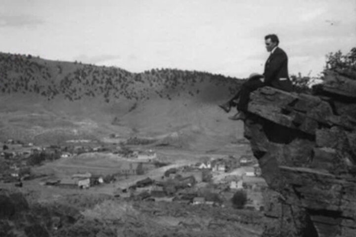
Upon reaching the crest of the ridge, I stand on a topographical anomaly. An ancient fault line has created an east-west angled ridge here that juts out into the plains from the predominantly north-south orientation of the Rocky Mountains. The resulting views up and down the Front Range are second to none. To the south I can make out the graceful outline of Pikes Peak, a crow’s flight of over 100 miles away. To the north is a sweeping view up the edge of the northern Front Range clear into the open rangelands of Wyoming. The mountains seem to crash onto the plains like waves on a beach, and I’m a spectator from the shore.
An interpretive sign along the trail tells of the ancient use of this location by those who came before us. Many stone artifacts have been found in the area. Hundreds of generations of people over thousands of years have traveled here, camped here, and lived here. An indigenous hunter standing atop this ridge on a clear day 300 years ago could spot a bison herd or an unwelcome raiding party anywhere within a three-day’s ride to the north, east, and south. Countless communities have likely sheltered or wintered here for millennia as the south-facing slope blocked the northeasterly winds driving the stinging snows of Front Range blizzards.
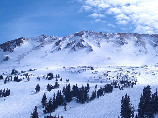
The landscape around Lyons can resemble the western slope of Colorado with its dry mesas and slanted bands of colorful sandstone rock layers. That sandstone is what makes the history of Lyons unique amongst Colorado communities. While other towns in the area were formed from gold, silver, and coal mining, Lyons was, and still is, a sandstone quarry town. In fact, the geologic “Lyons formation,” is named after the town, not the other way around.
A quarter of a billion years ago, at the dawn of the dinosaur age, there were quartz sand dunes here. This sand was compressed and solidified by subsequent sediment deposition. Millions of years of mountain building then exposed the layer as it was pushed up and then eroded by wind and water. These processes formed a stone with natural fracture points resulting in flat layers with varying thickness called flagstone.
The first humans to make use of the flagstone were archaic Native Americans who used it for building material as early as 6,500 years ago. In more recent times immigrants from the east, mostly European in origin, industrialized the extraction of the stone starting in the late 1800s. The beautiful rose-colored Lyons sandstone, said to be the hardest sandstone in the world, has been used all over the planet including in historic buildings in the town of Lyons itself and many of the University of Colorado Boulder’s iconic stone structures. Some of New York City’s famous brownstone row houses are built of Lyons sandstone, shipped there by rail on the Denver, Utah, and Pacific Railroad.
Lyons, true locals
Back in Lyons from my morning hike, I venture into the Barking Dog Café on Main Street for a coffee and a Wi-Fi connection. They are busy, and it seems most of the customers know each other. A group of about eight sit around a large table in the middle. They look like a made-for-TV version of small town neighbors.
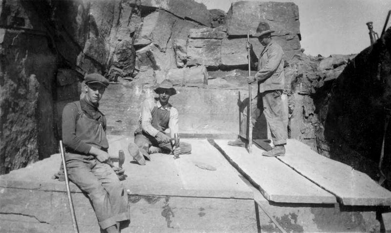
A quarry near Lyons, some with men at work cutting stone. Photographer: Mabel Downer Durning
The group chats a bit nervously about the weather forecast. “It’s supposed to rain a lot today,” says one. “No, last I checked it was only a thirty percent chance now,” an older man replies hopefully. They laugh a bit when another of them playfully points out the rain drops already appearing on the storefront window. Then there is a bit of silent contemplation before the topic of conversation shifts to recent wildlife sightings. The flood of 2013 is most certainly on their minds, but no one speaks directly of it. This is a town that has fully rebuilt from that devastating event and surely does not want a repeat.
“Lyons feels like the anti-Estes Park.” This is how I introduce myself to the owner of the Barking Dog working behind the counter when the crowd thins. “It’s more of a locals’ town, isn’t it?” I ask. He seems to agree with my observations. When I mention the large group that had since left, he says, “We agree on almost nothing, but we all make it work.” I get the sense that he knows them all as friends.
Indeed, Lyons is a locals’ town through and through. It is the proudly overlooked foothills gateway to the two canyons that lead to America’s fourth most visited national park and the internationally known mountain resort community of Estes Park. In fact, in the early days of Rocky Mountain National Park, Lyons was known specifically as the “Double Gateway to the Rockies.” There was even a giant arch over the road proclaiming it as such right about where the Barking Dog Café is located.
The arch is gone now, but the town still serves as a gateway to the northern Front Range high country. In my youth I passed through Lyons many times on my way to trout fishing spots on one of the forks of the St. Vrain River. At the west end of town, Main Street splits. Go left on Highway 7 for the South St. Vrain or turn right up Highway 36 for the river’s north fork. Either way gets you to Estes Park. Either way takes you through those canyons that flooded in 2013 exactly ten years ago.
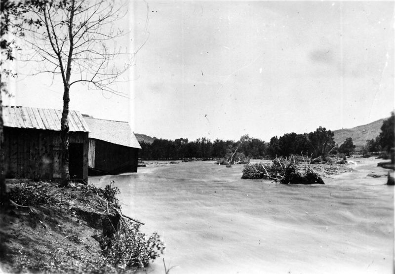
1894 or 1895. Views of Lyons taken after a flood
The flood
The 2013 flood was caused by a 1,000-year rain event as up to 18 inches of rain fell over a couple of days in the foothills. That’s a full year’s precipitation for this area. All that water had to flow downhill, and in the mountains the downhills are steep, and the valleys are narrow. This created a funneling effect as the sheets of rainwater careened down the mountain sides too quickly for the ground to absorb. The water flowed from all directions into the constriction of the canyons. Inside the canyons, walls of accelerating water and debris roared out to the plains carrying trees, boulders, pieces of roadway, and houses.
The double gateway from Lyons into the Rockies turned into a double-barreled water cannon. The flood roared into the town from two directions like converging tsunamis. Stream flows are measured in cubic feet per second (cfs). At the peak of the 2013 flood, the St. Vrain in Lyons reached a historical record 24,000 cfs. For perspective, its normal flow in mid-September is about 50 cfs. Nearly 500 times the normal volume of water and its accompanying debris unloaded on Lyons. Massive cottonwood trees were thrust down the canyon like toothpicks. Truck-sized boulders were dislodged from the earth and rolled around like the bowling balls of the gods.
The town was devastated. The National Guard evacuated residents on September 12, and many of those living in the canyons above town were plucked away to safety in Chinook helicopters. Shortly after the flood I tried to visit Lyons, but the National Guard was only allowing residents in, for good reason. All the town’s services and utilities were wiped out, many people’s homes were lost, and the town was a disaster area.
At the peak of the 2013 flood, the St. Vrain in Lyons reached a historical record 24,000 cfs. For perspective, its normal flow in mid-September is about 50 cfs.
Weeks after the flood I was able to make it to the mountain hamlet of Glen Haven, near Estes Park, after temporary road repairs were made to one of the canyons. Glen Haven looked destroyed, but what I remember most was a car perched in a tree about 15 feet off the ground. It was hard to believe that the tiny little brook that flowed through Glen Haven had exploded into the roiling whitewater deluge that pushed a car up into a tree.
To the people of Lyons and surrounding flood-damaged communities, the flood of 2013 must have seemed like a biblical event. Even the very courses of these streams were permanently altered by the flood, dramatically so in some areas. But when considered through the long lens of geologic time, floods like these, and much bigger ones, are commonplace in those canyons. They have happened many thousands of times over millions of years.
These types of floods are, in fact, the reason those canyons even exist. It takes massive volumes of fast-moving water to carve them, to dislodge those truck-sized boulders from one place and deposit them in another, to scour an inch or two at a time from sandstone ledges, and to push tons of debris and sediment downriver and into the plains like a behemoth excavator. These floods are, indeed, the reason why the Lyons sandstone formation is exposed on those canyon walls and therefore the reason why the town of Lyons came to be. All things in nature are connected.
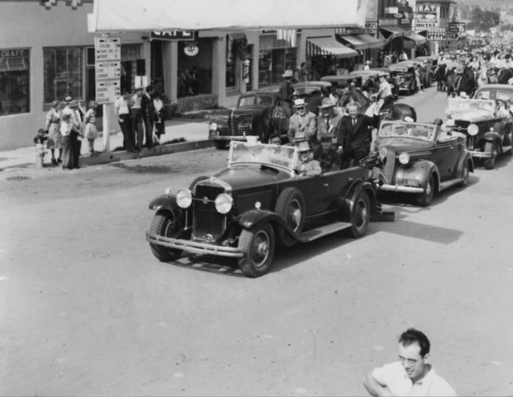
1939. Lyons to Estes Park North St. Vrain Highway dedication
Founding Lyons
It’s mid-morning now, and I walk out of the Barking Dog Café into light rainfall. The sky is darker, the clouds are lower. The air has an unusual humidity and thickness to it, betraying its Gulf of Mexico origins. Harold’s final haymaker is arriving as expected. Will he conjure up more floods?
I walk into the Lyons Redstone Museum situated a block north of the Barking Dog on High Street. This was the original one-room schoolhouse built in 1881 using locally quarried sandstone of course. A second floor was added in 1895 and an addition to the ground floor in 1902. The Lyons School held classes for nearly a century until finally closing its doors to students in 1977 when construction of a larger school was completed.
The school’s — now museum’s — second story is a wood frame structure that sits atop the sturdy sandstone-based first floor. This created a bit of a shaky experience during the notorious winds that can crash down into Lyons from the mountains to the west. The swaying of the building could be so bad that school was sometimes canceled because of wind. While many Colorado kids hope for a “snow day,” the kids of Lyons enjoyed “wind days” off from school! The museum stands today as one of the oldest surviving original buildings in Lyons.

2013. Lyons Redstone Museum, formerly the Lyons School. Photo: Doug Geiling
Inside the museum is a surprisingly extensive collection of historical books and exhibits. It operates on voluntary donations, and it’s well worth a visit. The land for the original Lyon’s school was provided by the town’s founders, Edward and Adeline Lyon of Connecticut. Like many arrivals from the east during that era, the Lyons came west on the advice of a doctor as it was thought that the clean air of the Rockies was an elixir for various health ailments caused by “bad air” in eastern U.S. cities at the time.
There were earlier European-American settlers to the land that would become Lyons. They arrived in the early 1860s as either disappointed gold prospectors or homesteaders. But even before them there was the occasional mountain man who ventured into the canyons above Lyons to trap beaver in the early 1800s.
One such adventurer was the son of a French aristocrat who became a Mexican citizen named Ceran St. Vrain. St. Vrain formed the “St. Vrain” half of the Bent-St. Vrain Company that established and ran the famous Bent’s Fort in eastern Colorado. Their northern trading outpost, Fort St. Vrain, was located on the South Platte River in northeast Colorado at the confluence of a large tributary flowing in from the west. The tributary would later be named the St. Vrain River.
By the time the town of Lyons was founded in 1881, the fur trapping days were long gone, and America was well into its Gilded Age of early heavy industry and railroad barons. But, around this time, Lyons became known as a tourist destination as Denverites and others boarded shiny new trains to the Double Gateway to the Rockies to spend a day or a week in leisure. Through the early 1900s several health resorts sprang up in the St. Vrain Canyons. And the picturesque mountain enclave of Estes Park beckoned to the west, made globally famous by the blockbuster memoir of Englishwoman adventure travel writer Isabella Bird — A Lady’s Life in the Rocky Mountains.
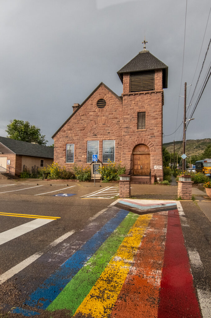
Old Stone Congregational Church. Photo by Dustin Doskocil
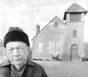
1977. Frank Weaver, Lyons historian, standing in front of the Old Stone Congregational Church; now on the National Register of Historic Places.
Constructing and rebuilding
The cement industry arrived in 1910 and, for a time, destroyed the sandstone quarry business. But sandstone was soon revived, focusing more on the decorative landscaping material that it remains famous for to this day. Since the middle of the 20th century, Lyons has been overshadowed by its larger Front Range neighbors, Boulder and Longmont and its more touristy cousin to the west, Estes Park. But perhaps that is all for the better as it seems to be comfortable in this role. As a Front Range native, I’ve always appreciated the mere existence of Lyons. It is unique among Front Range towns and cities for its history, its low-key character, and its geology.
I step out of the Lyons Redstone Museum into a driving rain. Harold has landed his punch. The wind has picked up, and the rain soaks me in sheets. This is not like the typical brief afternoon summer storm in the Rockies. The rain is hard but not accompanied by lightning bolts and thunder booms. I worry about this weather as I drive east away from town. Will there really be a repeat of 2013 almost ten years to the day?
No. Like an over-the-hill boxer, Harold’s haymaker turned out to be a glancing blow. The heaviest of the rain stayed well east of the mountains, and the anticipated floods did not materialize.
In 2013, as the people of Lyons surveyed a devastated town, they knew their town would never be the same. They knew it would come back better. And it has. On the one-year anniversary of the 2013 floods, the town of Lyons held a series of celebrations. At that time, they still faced several more years of recovery efforts. But the celebrations were for their resilience, hope, and optimism. It was for their determination to build the town back, not to what it was, but to what it could be — something even better, even stronger. And, ten years on, they’ve done just that. Lyons may have been knocked backwards by a wall of water, but the town’s residents have proven they are as rock solid as Lyons sandstone.
 The Muffler Man
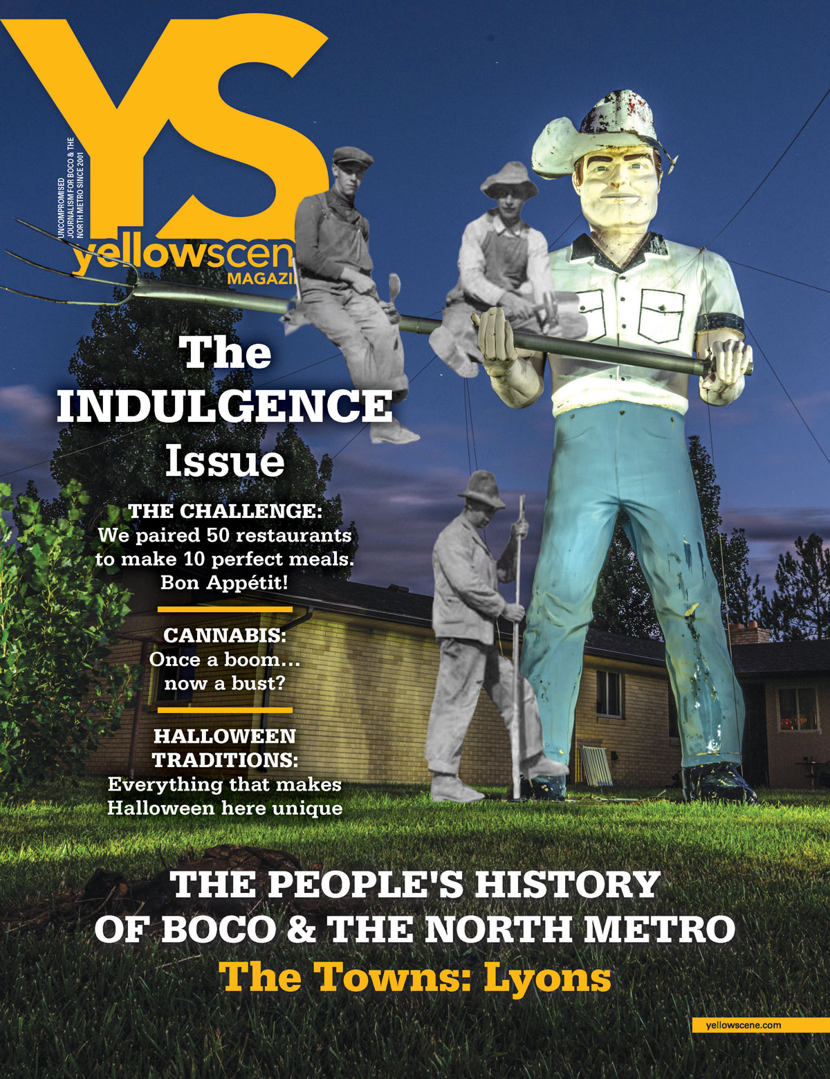
The giant cowboy with a pitchfork on the cover of this issue is a piece of kitschy Americana from the 1960s. He is one of a few dozen original “muffler men” still standing around the country and one of only two in Colorado, with the other in Greeley. Muffler men were made by the International Fiberglass Company out of California and were commissioned by roadside businesses wanting to draw the attention of curious passersby. They are known generically as “muffler men” because some were built for muffler and tire companies. But the first one, a “Paul Bunyan” held an ax and promoted the Paul Bunyan Café along Route 66 in Flagstaff, Arizona. Others held, or still hold, giant hot dogs, burgers, frosty beer mugs, or simply stand with outstretched forearms like the one in Greeley. The one just outside of Lyons holding the pitchfork, located on a private residence, is colloquially known as “Ranch Cowboy.”