


Eldorado Springs – Portal to the Mountains
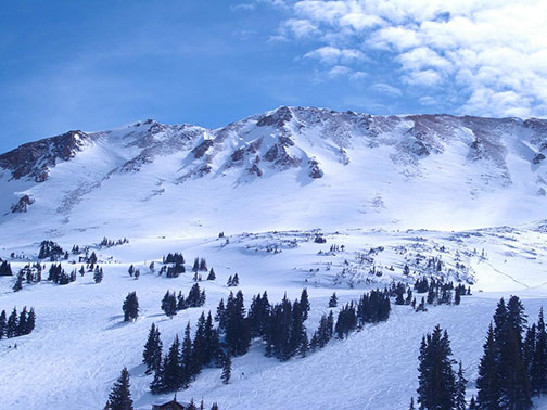
Billion-year-old stone rises vertically over the green-tinted waters of a mountain stream. Red-barked ponderosa pines that smell of vanilla drape the steep slopes between the rocky ramparts. As the sun tracks behind the clifftops, the canyon floor often remains shady while the rock walls above illuminate in brilliant sunshine. The texture and contrasting light of this place can be stunning.
This is Eldorado Canyon just to the south of Boulder. Nowhere else in the Front Range features a more abrupt transition between the mountains and the bright white immensity of the high plains, a place the settlers used to call the Great American Desert.
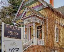
There is a village at the point where South Boulder Creek spills out from the canyon and onto the plains. Some call this place “hippy canyon” for its reputation as an eclectic non-conformist community. Its official name is Eldorado Springs, an unincorporated town of about 560 people.
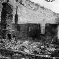 Over a century ago Eldorado Springs was a much livelier place than it is today. In the early 1900s up to 40,000 people a day would visit to experience the natural mineral springs and the resort that was developed around them, created originally by Frank Fowler. There were three hotels there including the Crags which burned to the ground in 1912. When the original Eldorado Resort opened, its spring-fed swimming pool was said to be the largest in the nation. In 1916 future President Dwight Eisenhower and First Lady Mamie celebrated their honeymoon at Eldorado Resort.
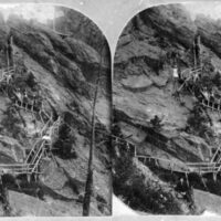
Eldorado Springs attracted adventure seekers from its beginning. From 1906 to 1948 local daredevil Ivy Baldwin walked a high wire that was strung up between the canyon walls. Never using a safety net, Baldwin would walk the wire some 600 feet above the bottom out to the middle, stop and do a headstand on the wire, and then walk the rest of the way to the other side. He performed his last high wire act at the age of 82.
In the 1950s the canyon began to attract a new type of adventurer, the rock climbers. Known then as “marmots,” the climbers soon began to place fixed routes up the sheer walls of the canyon. The now world-renowned climbing destination of Eldorado Canyon features hundreds of known climbing routes with names like The Evictor, The Naked Edge, and Must’ve Been High. The canyon’s rock walls have been scaled by many of the nation’s legendary climbers including Tommy Caldwell, Lynn Hill, and Alex Honnold.
 The canyon was designated a Colorado state park in 1978, and it’s not just for climbers. The narrow park road ends at the west end of the canyon where the landscape opens up and the stream flows gently by. It’s a wonderful place for a picnic or a short hike. If you visit the state park, don’t forget to stop and take a stroll through Eldorado Springs itself where you might stumble upon an open-air sculpture garden and other quirky sights. Bring a water jug and a couple bucks to fill it with pure Eldorado Springs water. Then take a dip in the recently renovated historic swimming pool. All of this makes for one of Boulder County’s most rewarding summer afternoons, right on the edge of the mountains.
The now world-renowned climbing destination of Eldorado Canyon features hundreds of known climbing routes with names like The Evictor, The Naked Edge, and Must’ve Been High.
Gunbarrel, Hygiene, and Niwot – The Center of the Universe
On a sunny spring day a very long time ago, a lone scout stood atop a treeless hill. From there she could see for days in every direction except over the high mountains to the west. Those mountains were clothed in rivers of alpine ice above forested foothills. There were real glaciers in those mountains back then — the kind that carve valleys out of rock.
The high plains to the east of these ice-bound mountains were cooler and drier than they are today. It was a well-watered desert. The glacial-melt rivers flowing into this dry land from the mountains were probably much larger than today’s creeks and occasionally brought enormous floods that altered the landscape by moving massive amounts of sediment around.
The scout, standing atop this hill, was looking for a beast large enough to feed her clan for weeks — a mammoth or perhaps a giant land sloth. She was also wary of predators larger and fiercer than anything known to modern man like cats with six-inch fangs and bears twice as large as a grizzly.
This hill is known today as Haystack Mountain, and it was likely a place of high importance for humans in this area for thousands of years because of its unique topography as a solitary vantage point. Many archeological artifacts have been found near Haystack Mountain, including a stunning 13,000-year-old cache unearthed recently from the backyard of a north Boulder home. The 300-foot hill is a geologic remnant of Tabletop Mountain, a broad mesa to its northwest. The St. Vrain River carved away a piece of the mesa. Wind and water shaped the orphaned chunk of land into a cone that now stands like an oddball over the high plains between Boulder and Longmont.
 The Arapaho Tribe called the little mountain Nenestce, meaning “the standing alone mountain.” Like our Clovis-era scout who climbed the hill looking for a mammoth, Arapaho hunters in the early 1800s would have used its summit for a bird’s eye view of any nearby bison herds. Given Nenestce’s importance to the Arapaho as a camp, it is possible — though not known — that a future Arapaho chief was born near this mountain around the year 1825. His name would be Niwot, meaning Left Hand.
Niwot had two siblings, a brother named Neva, and an older sister named Mahom who married John Poisal, a white trapper. Poisal and his Arapaho in-laws taught each other their native languages during a brief period of time when peaceful coexistence between the Arapaho and encroaching pioneers may have still seemed attainable. But a series of converging events and an imperialist-oriented young nation would soon smash that fleeting dream. The Arapaho and other Native American tribes of the area would be overrun, treaties would be broken, and their land and livelihoods would be stolen from them.
The massive land grab of the Mexican-American War opened up enormous territory for settlement expansion to the west and southwest. The first settler waves went through or around Colorado. First the Mormons headed to Utah as they fled persecution in the Midwest, then a wave of gold seekers set their sights on California’s Sierra Nevada Mountains. But when gold was discovered in Colorado in 1858, a tectonic clash of civilizations began along the Front Range as this wave of settlers intended to stay.
Many archeological artifacts have been found near Haystack Mountain, including a stunning 13,000-year-old cache unearthed recently from the backyard of a north Boulder home.
As the pioneer horde descended on his people’s land, the English-speaking and pacifist Chief Niwot and his brother Neva were pulled into the eye of this storm. They both became reluctant statesmen forced to help their people navigate through a growing catastrophe. While Niwot is the more recognized and historically documented of the two brothers, it was Neva who traveled all the way to Washington, D.C. to meet with President Lincoln in 1863.
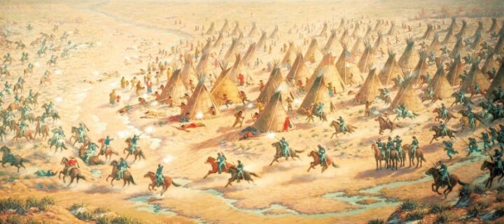
Neva and other Native American delegates received a sympathetic ear from the president. But their long journey east yielded little substance as their plight was overshadowed by the nation’s existential struggle in the Civil War. A little more than a year after Neva’s trip to Washington, his brother Niwot would be dead, a victim of a horrific massacre at Sand Creek southeast of Denver, led by a U.S. colonel and supported by Colorado’s territorial governor.
Aggrieved and likely enraged by the massacre and the killing of his brother, Neva finally gave up on the whites and, at least for a time, took up arms to fight alongside his young warriors across the contested plains. There seems to be no known historical record of Neva’s fate after that, but we know that he never accepted reservation life. According to Donlyn Arbuthnot, whose family was among the first whites to settle in the Haystack Mountain area, Arapaho people would return to Haystack Mountain at times well into the 1880s and even the 1890s. It is plausible that Neva, as an elderly man, may have been amongst them. As Arbuthnot told me, Haystack Mountain — Nenestce — “was an important place for them.”
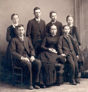
Arbothnot showed me the meticulous family history binders she had compiled as we sat near the fireplace at Lafayette’s East Simpson Coffee Company. There are of course the Arbuthnots, but there are also the Baders, the Coes, and the Hills, all part of Donlyn Arbuthnot’s family lineage, all of them instrumental in the settlement of the area around Haystack Mountain and the emergence of the communities of Niwot, Hygiene, and Gunbarrel. It’s hard to know where to start with this rich background, but I like the story of Donlyn’s great-great grandfather J. George Bader.
One fine day in Iowa in the summer of 1866, Union war veteran J. George Bader, his wife Mary, their daughter, and a son prepared to embark on a life-changing journey westward. Bader marched through Georgia with General Sherman late in 1864. Perhaps even then he dreamt of a future life near the Rocky Mountains for as he marched with the Union Army, he collected some apple seeds along the way.
Back in Iowa the wounded soldier placed those apple seeds carefully in the pockets of his trousers. Together, the Baders climbed into their wagon and set forth to chase the dream that was the American frontier. In addition to his apple seeds, J. George Bader put a live beehive in the wagon, which made it all the way to Colorado. It seems he had an idealistic expectation of apple pie and honey in a new land, as far away as possible from the horrors of a war that still tormented his soul.
After a long overland journey, J. George Bader reunited with a brother in the hills above Boulder. Nicholas Bader had arrived in 1860 looking for gold, and by the time his brother arrived, he was one of the first official landowners in what would become Boulder County. His land was near Haystack Mountain.
Mary Bader
Arbuthnot and children
In the 1880s Mary Bader, J. George Bader’s daughter who traveled with him to the frontier as a child, taught at the school her father built near Haystack Mountain. During good weather Mary would open the schoolhouse windows and leave homemade marshmallows for the Arapaho who would often stop by and listen to her lessons. One morning she found a beautifully beaded pistol sheath that the Arapaho made and left for her at the school as a gift.
Arbuthnot also told me that a group of Arapaho, possibly led by the mysterious Neva although not confirmed, once looked after Mary Bader’s young daughters when she and her older sons became unexpectedly snowbound in the foothills above Boulder.
Relations between the settlers and the Indigenous peoples of this land were far more varied than we often recognize, and instances of compassion and kindness are often overshadowed by the tragic events and trends of history.
To me, these wonderful stories help remind us that the official historical record can create an overly simplistic perspective of a past that was much more nuanced. Relations between the settlers and the Indigenous peoples of this land were far more varied than we often recognize, and instances of compassion and kindness are often overshadowed by the tragic events and trends of history.
The Bader brothers were not the first of Donlyn Arbuthnot’s forbears to arrive in Colorado. In June of 1859 Carson Arbuthnot, also a great-great grandfather of Donlyn’s, arrived from Iowa with his wife and four sons. They, too, set their sights on the land around Haystack Mountain as a home base but spent many weeks at a time in the mountains above Boulder prospecting for gold. Carson Arbuthnot became the first sheriff of Gold Hill, one of Colorado’s first mining settlements and today a national historic landmark.
Donlyn Arbuthnot acknowledges the role her family played in the displacement of Native Americans. But, as we have already seen, history is always more complicated than convenient judgements of right versus wrong and black or white. The story of Carson Arbuthnot and his sons provides a fascinating example of the complexity and nuance of history as well as the range of human nature.
Arbuthnot told me that her great-great grandfather Carson was horrified by the Sand Creek Massacre and did not at all approve of it. But three of his own sons — Donlyn’s great grandfathers — represent the full spectrum of pioneer sentiment at the time. “I call them the good, the bad, and the ugly,” said Arbuthnot. “My great grandfather William was the good because he tried to reason with Nichols — Chivington’s Boulder-based deputy — to not attack the Indians. The bad was Samuel because he supplied the army with horses and food. And James was the ugly because he participated in the massacre.”
Farmers in Niwot
Kinetic clashes like the massacre at Sand Creek were a manifestation of a much more systemic civilizational incompatibility between the pioneers and the Native Americans. “It’s not just things like the Sand Creek Massacre that were deadly to them,” said Arbuthnot. “Fencing was just as much of a problem.” As Arbuthnot explained, the pioneers who wanted to qualify for land ownership would typically use fencing to mark property boundaries. This created, in a few short years, a patchwork of fenced off land that was suddenly restrictive to Native Americans whose way of life depended on overland movement over great distances as they flowed with the free-ranging migration of the bison herds.
Another major disruption was irrigation. Arbuthnot’s forebears were expert ditch diggers who brought an Iowa farming know-how to the parched prairie. In this regard they were quite innovative. By the late 1860s their focus turned from mining towards agricultural expansion, and for that they needed more water than little Left Hand Creek could provide. So, the Arbuthnot brothers — the good, the bad, and the ugly — trekked up into the mountains and managed to find a place where the headwaters of the South St. Vrain River could be diverted into Left Hand Creek. There they dug a diversion and captured the St. Vrain’s waters.
Longmont area settlers woke up one day and noticed that their river had suddenly lost most of its water. So, they went upstream to investigate. When they found the diversion high in the Front Range foothills, they promptly blew it up with dynamite, restoring the St. Vrain to its natural flow. The Arbuthnots, of course, noticed their creek drop back down to prior levels, so off they went back up to the mountains to rebuild the diversion, except this time they left a sentinel as they knew the Longmont folks would be back again. Sure enough, the Longmont people trekked back into the hills. When they encountered the sentinel, a brief gunfight erupted before cooler heads prevailed, and the parties decided to take the matter to court.
The court decided in favor of the Arbuthnots on the basis that the Longmont settlers were not actively using the water in the St. Vrain. As Boulder resident and retired economist for the American Aid Program Joe Stepanek told me, this decision helped set the precedent for “western” water rights law in the entire western part of the U.S. which diverged from the typical “riparian” water rights used in much of the world, including the eastern U.S. With riparian water law “if you own the land, you own the water,” said Stepanek. Western water law is based on the concept of prior appropriation. In the Wild West this allowed settlers to, as Stepanek put it, “take water by gunpoint,” which is precisely what happened at the Arbuthnot’s diversion when their armed sentinel protected it from dynamite-toting Longmont settlers.
More than a century and a half later that diversion is still there, although it has since been reinforced with concrete. It is managed by the Left Hand Ditch Company, a non-profit that provides water to shareholders in the Niwot area.
The steel horse arrived in the 1870s. The settlement of Niwot, like Broomfield to the south, was born as a railroad hub centered around a new train depot on the Colorado Central Railroad from Boulder to Cheyenne. We have Porter T. Hinman and Ambrose S. Murray to thank for the confusing diagonal orientation of Niwot as they platted the community along the direction of the tracks.
The steel horse arrived in the 1870s. The settlement of Niwot, like Broomfield to the south, was born as a railroad hub centered around a new train depot on the Colorado Central Railroad from Boulder to Cheyenne.
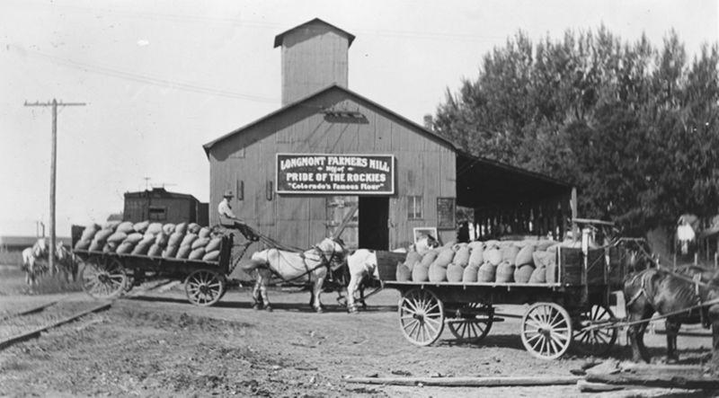
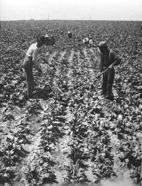
By the dawn of the 20th century, the railroad was used to haul a new cash crop, the sugar beet. According to Arbuthnot, the Coe family, also her ancestors, first brought sugar beets to the area to help feed livestock before it later became a commodity for human consumption. The Coe family land was located where IBM eventually built their campus near Gunbarrel. When they sold some of that land before IBM existed, it went for one cent per acre.
As the area’s sugar beet industry grew, an earthen ramp was built near the train tracks in Niwot which was used to dump sugar beets into the cargo cars. This place was referred to as the “beet dump.” If anyone is thinking of opening a dive bar in Niwot, The Beet Dump would be a fantastic name with historical significance!
A few miles north of Haystack Mountain a different kind of settlement was established at a place the original settlers called Pella, or Pella Crossing. This is where Donlyn Arbuthnot finds her mother’s side of her local family history. Arbuthnot’s great grandmother Sarah Virginia Hill had tuberculosis and came west for the clean air and the sanatorium opened here by local Mennonites in 1882. Hill died six months after her arrival. The young, now-orphaned son she brought with her remained in the area, raised by the Hake family on land that would later become Baseline Reservoir near Louisville.
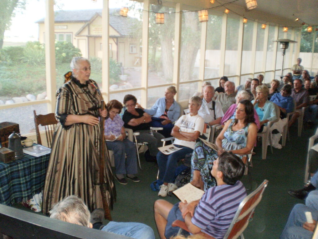
Niwot history storytelling
At some point Pella became known as Hygiene because of the Mennonite sanatorium. “It’s just always been a quaint, nice little town,” said Arbuthnot. Until recently Hygiene was also the home of the official world’s largest plains cottonwood tree. Until it died of old age in 2012, the tree was locally known as “The Gentle Giant,” and it once took a whole class of third graders holding hands to stretch all the way around its 36-foot-circumference trunk.
The Gentle Giant may have been planted by one of Hygiene’s early settlers as the plains cottonwood is a fast-growing and short-lived species that rarely lives more than 150 years. Arbuthnot explained to me how the early settlers would uproot cottonwood saplings from the Platte River watershed to the east on their westward journeys so that they could plant them in their nearly treeless new lands. Today we are accustomed to cottonwood-lined byways and leafy neighborhoods, but in the 1860s there were very few trees in these high plains. Next time you drive the backroads in our area, take note that most of the cottonwood trees you see are likely the progeny of saplings hauled by wagon and planted by the hands of frontier pioneers.
According to Arbuthnot it was one of those rare trees that inspired the peculiar name of the community of Gunbarrel. Local soldiers would train their guns on a lone tree in the distance from their elevated position, and the place became known as Gunbarrel.
Today, Gunbarrel is a quiet community developed in part as a result of the building of IBM’s large campus nearby. Perhaps the finest views of the Front Range are from the elevated land in and around Gunbarrel.
Relations between the settlers and the Indigenous peoples of this land were far more varied than we often recognize, and instances of compassion and kindness are often overshadowed by the tragic events and trends of history.
The 1920s and 1930s were a time of growing pains and social upheaval. The Ku Klux Klan emerged in the 1920s to target Catholics and minorities in a time of diversification as farming and mining labor drew in newcomers from around the world. Arbuthnot said that the Klan once burned a cross on the top of Haystack Mountain, and although I could not verify this in the historical record, it is plausible since cross burnings were common during this time.
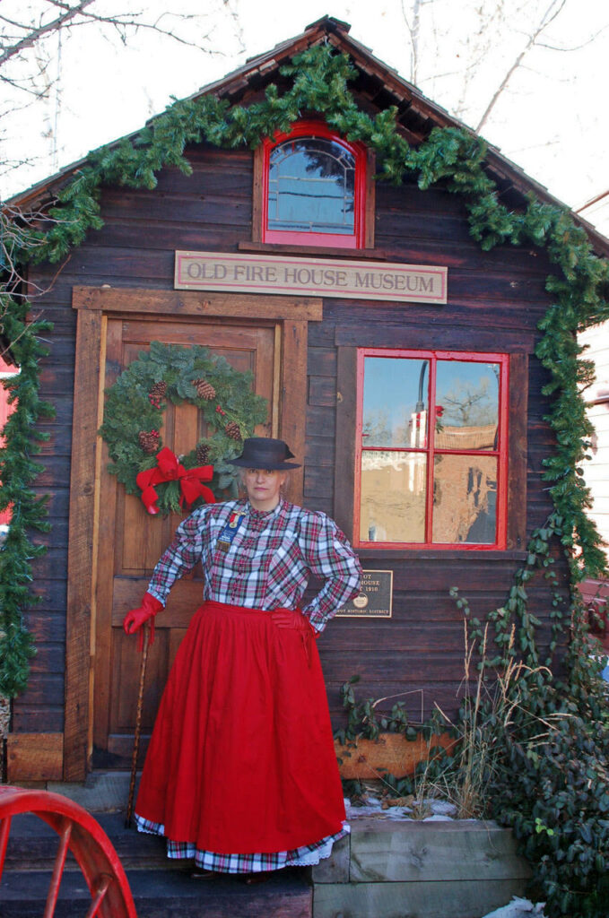
Niwot Museum
As the Klan fell out of favor, prohibition arose. It is said that Boulder’s sheriff used to stash bootleg liquor in a cave at White Rocks near Gunbarrel. According to Arbuthnot, the longest-running unsolved murder in Boulder County involves a sheriff deputy who may have been killed by the same sheriff to prevent the do-gooding deputy from exposing his bootlegging operation.
By mid-century these places in between were feeling the growth around them as Boulder and Longmont expanded into small cities, freeways were built, and tech companies moved in, creating a more diverse economy. But, unlike the larger towns and cities around them, the settlements of Eldorado Springs, Niwot, Hygiene, and Gunbarrel have remained the “places in between” that help complete the unique character of our region.
Although it is now less visible due to the cottonwoods descended from pioneer hands and the modern leafy neighborhoods that followed them, Nenestce (Haystack Mountain) still remains. A 105-acre parcel of land that includes the mountain itself is currently on the market for a cool $10.5 million. After learning of the hill’s historical and indigenous significance, it seems that this land would be a good candidate for acquisition as a Boulder County Open Space. It would be wonderful to see it preserved and honored as the unique and sacred landmark that it truly has been for thousands of years — the constant center of the universe in this land of change.
COVER PHOTO: Dustin Doskocil
Photos Provided by the Carnegie Library for Local History, Denver Public Library Special Collections, Greeley History Museum, Longmont Museum, and USGS Historical Mining Photographs